Shows
Hong-Soon Park’s “Mid-Report of Daedongyeojido Project”
Daedongyeojido (literally “Grand Map of Eastern Territory”) is the title of a map of Korea made by the Chosun Dysnasty cartographer and geologist Kim Jeongho, in 1861. More than a century later, the artist Hong-Soon Park has taken on the formidable task of documenting Korea using a 4x5 camera. Since 1997, Park has photographed the Baekdu mountain range (including Mt. Baekdu), the Han River, Mt. Jiri, and Korea’s western and southern seas. “Mid-Report of Daedongyeojido Project” at the Museum of Photography, Seoul, marks the mid-point of Hong-Soon Park’s own Daedongyeojido project, presenting 70 gelatin silver prints taken over the last 15 years.
The name “Daedongyeojido” carries significant weight in the history of modern Korea. Kim’s map—comprising of 22 uniform woodblock-printed sections, altogether three meters wide and seven meters high—is considered the most accurate map of the peninsula before the Japanese occupation (1910–1945). Cartographic depictions of the country created by the occupying forces were distorted in order to repress Korean cultural identity, as well as become aids for Japan’s exploitation of the colony’s natural resources. Such maps were also used as education tools during the occupation, affecting Koreans’ knowledge of their country for future generations. For Park and many others of his generation, Daedongyeojido was symbolic of Korea’s scientific advances prior to Japanese rule, and thus was a source of national pride.
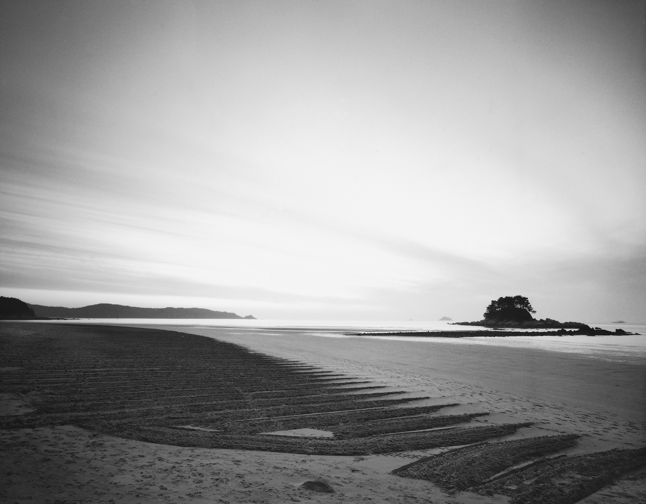
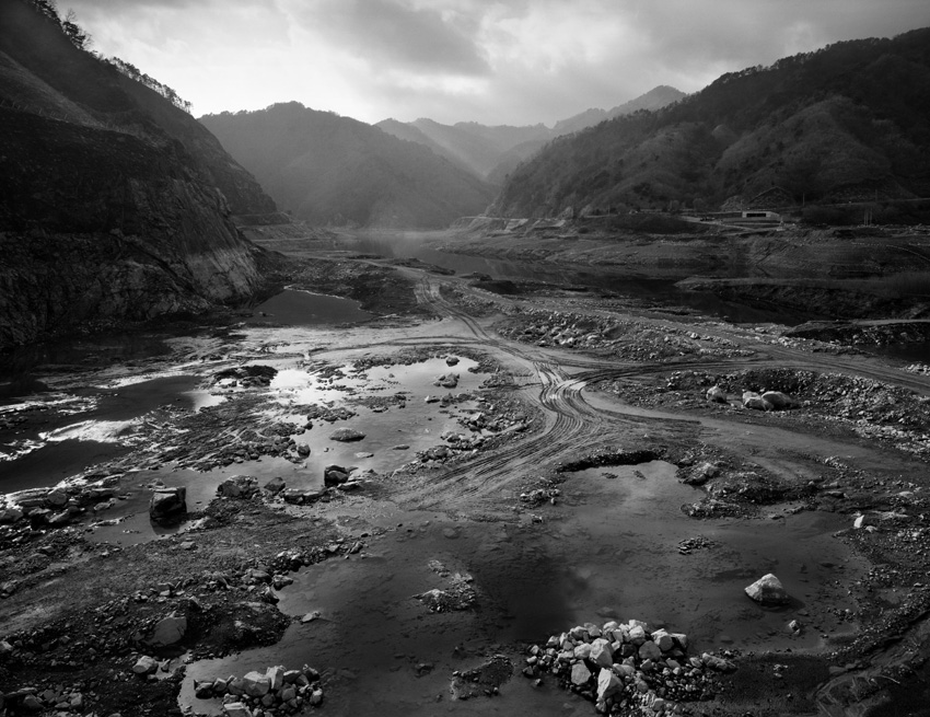
Park’s photographs for “Daedongyeojido” are rich in tone and detail, with a formal simplicity reminiscent of the grand depictions of the American West by Ansel Adams. Unlike the majestic American vistas romanticized by Adams, Korea’s changing landscapes in Park’s photographs are intimate and interwoven with the social and environmental concerns of our time. An abandoned limestone quarry that has caused landslides and polluted the drinking water of nearby residents is captured in Baekdudaegan-Jabyeongsan(Mt.) #06 (1998). West Coast-Chungcheongnam-do, Taean-gun, Hagampo(Beach) 04 presents gentle sand ridges made by tractors in 2008 that were assisting in the clean-up of Korea’s worst oil spill, off the coast of Anmyeon Island. Hangang(River)-Gangwon-do, Yanggu-gun, Pyeonghwaui Dam #02 (2004) shows tire tracks near the construction site of the Peace Dam, a controversial construction project during Kim Dae-jung’s presidency, which aimed to prevent the exaggerated threat of catastrophic flooding by the possible collapse of Imnam Dam in North Korea.
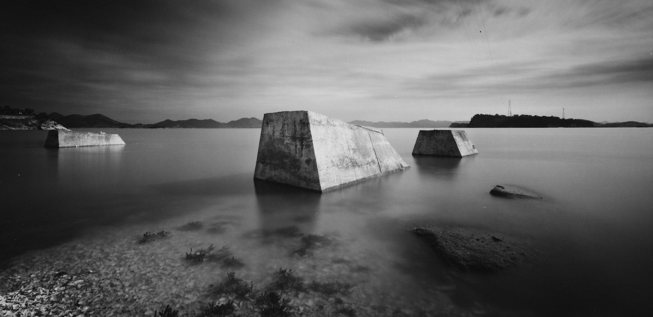
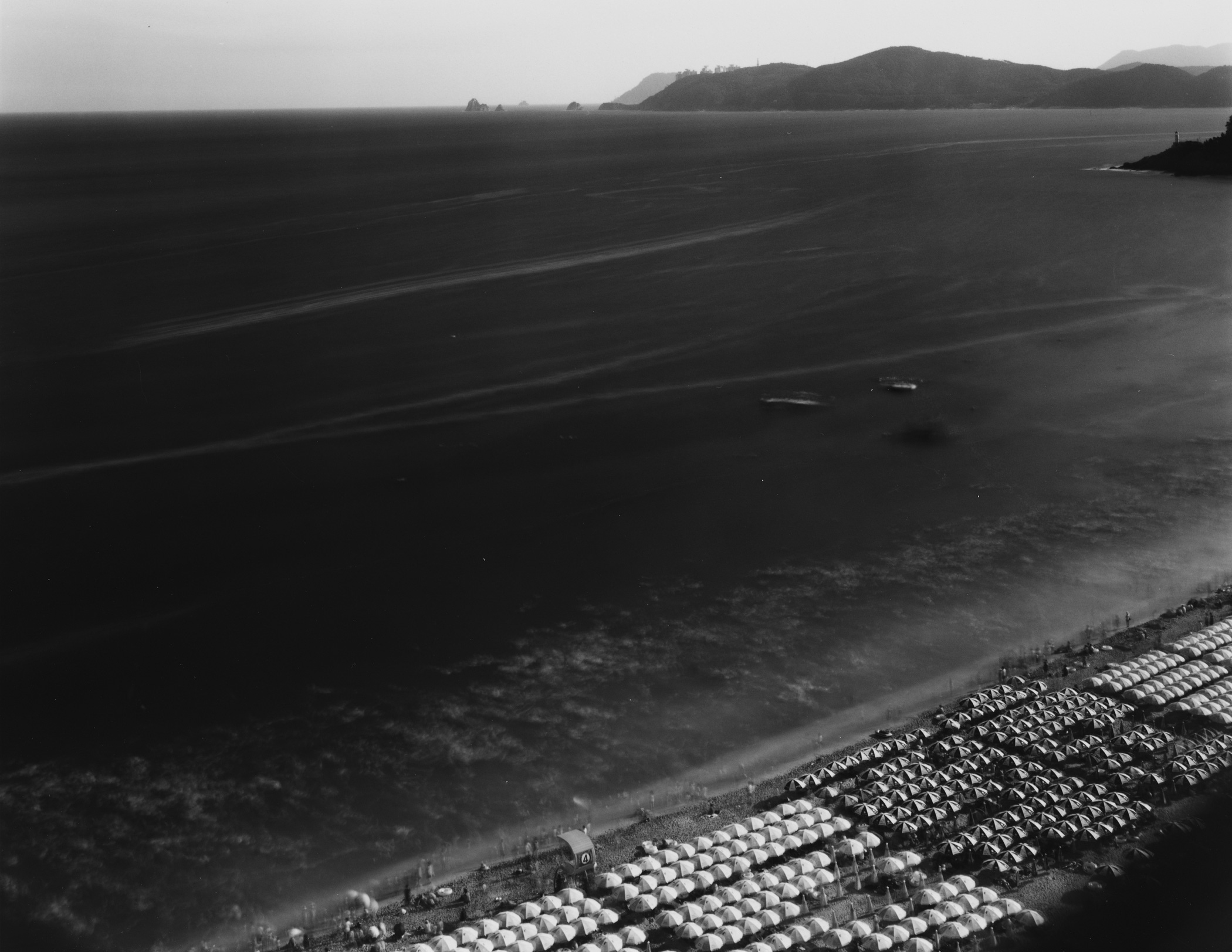
Though the content at the core of Park’s works is critical, the artist’s affection for Korea’s mountains, rivers and oceans—albeit changing—is clear and the resulting images are subdued and elegant. Concrete blocks left behind in The South Coast-Jeollanam-do, Boseong-gun, Beolgyo-eup, Yeojaman(Bay) (2009) take on the allure of Richard Serra-like installations emerging from the sea. In The South Coast-Busan, Haeundae-gu Haeundae (2009), swimmers invading Korea’s most popular beach—a coastal strip merely 1.5km long that serves half a million tourists each summer—appear as sea foam. Intentionally shooting in black and white, Park resists the temptation to provoke. Utilizing the format’s absence of color, he transforms waste, neglect and the destruction of nature into abstract motifs, sculptures and at times beautiful new landscapes. Park’s “Daedongyeojido” thus serves as a metaphor for the consequences of modernization as well as a documentation of the sacrifices a nation makes in the name of industrialization and progress, urging contemplation instead of judgment.
Technological progress was what allowed for the accuracy of the original Daedongyeojido map, and aided in its mass production and dissemination. In Park’s case, this may be his greatest challenge. The “Miracle of the Han River” has fueled Korea’s economy to becoming the world’s 15th-largest, significantly altering the visual landscape of the country. As Korea continues to develop to maintain its relevance within the global economy, so its natural landscape continues to undergo rapid change. And in this sense there is still much for Park to do. There are four additional major rivers and many islands in the South Sea that the artist intends to capture within South Korea alone. Park, who began “Daedongyeojido” as a life-long project, has found he must work against the passage of time. More poignant is the fact that Park’s “Daedongyeojido” could ultimately remain incomplete because the mountains, rivers and oceans of North Korea may never be within his reach.